The Struggle For Water

La Fuente De Chafariz

An Aljibe is a water collection and storage cistern. They come in many different shapes and sizes. Some collect rainwater run off from roofs and gardens for use in the home. Others collect natural spring water or ground water for use in an agricultural setting for crops and livestock.

Los Aljibes son cisternas de recogida y almacenamiento de agua. Hay muchos diferentes formas y tamaños. Algunos recogen el agua de lluvia de los techos y jardines para usarla en el hogar. Otros recolectan agua de manantial natural o agua subterránea para su uso en un entorno agrícola para cultivos y ganado.

Aljibes (Wasserreservoirs ) sind Wassersammel- und Vorrat Zisternen. Es gibt viele verschiedenen Formen und Größen. Einige sammeln Regenwasser von Dächern und Gärten für den Gebrauch im Haus. Andere sammeln natürliches Quellwasser oder Grundwasser für die landwirtschaftliche Nutzung für Pflanzen und Vieh.

Click to leave a Google Review
Montaña Tinache Circle

Montaña Tinache Circle

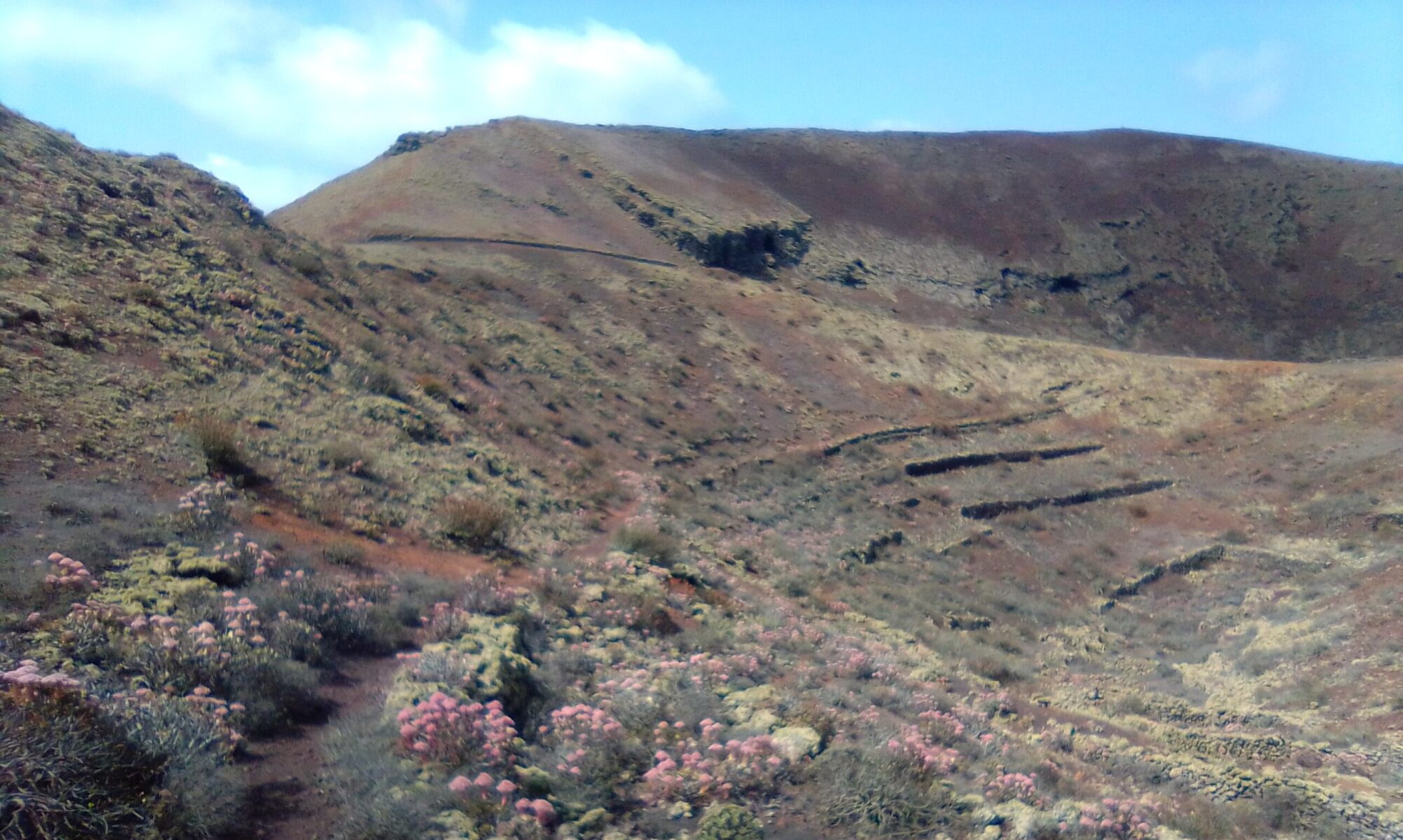
The Montaña Tinache Circle walk is a fairly easy walk, but some of the paths are quite narrow. The route is easy to follow and takes between 2 – 3 hours depending on water breaks and photo ops.

At the start of the walk you gradually climb up to the lowest part of the crater rim. Look out for the old abandoned pipework and water cisterns. To the eastern side of the old water storage tanks is a small path that leads around the outside of the volcano.

The path follows the route of the old water distribution pipeline. In places you can see the remains of the old pipe work and distribution nodes. Note how the channelization keeps its level as you circle halfway up the volcanic cone. As the path winds around the views gradually change from Mancha Blanca to Tajaste and then to the outskirts of Tinajo.

As you continue around the base of the volcano you find another abandoned water cistern. You can see here where they marked the water depth on one of the pillars, together with a date of 1929.

Click the button below to open a full description of the walk in a new tab.

Montaña Tinache Circle- History

To read more on the history of the area you can checkout the following sites Tajaste and Tinajo.

The sites are in Spanish, so if it helps I have made an attempt to summarise a few topics of interest in the History section.

Click to leave a Google Review

La Geria and Uga

La Geria & Uga

There are two walks in the La Geria and Uga area from the same starting point. Walk 1 has a very awkward section marked by a yellow diamond on the accompanying map. It is quite a steep scramble up a loose picón slope to the rim of Montaña Tinasoria. It is not an official trail, but once on the rim you are back on an official path. The views from the top are definitely worth the effort, covering La Geria and the southern reaches of the island.

Walk 2 is the shorter of the two, never leaves the official trail and is well marked paths or dirt roads all the way.

The crater rim of Montaña Tinasoria offers panoramic views over the entire southern reaches of Lanzarote. There are also some interesting ruins and the remains of a quite extensive water catchment, storage and distribution system.

Click the button below to open a full description of the walks in a new tab.

La Geria & Uga – History

To read more on the history of the area you can checkout the following sites:

The sites are in Spanish, so if it helps I have made an attempt to summarise a few topics of interest in the History section.

Click to leave a Google Review

Costa Teguise – Montaña de Tinaguache

Costa Teguise - Tinaguache

Costa Teguise – Tinaguache – There are a number of routes for this area. Some with hardly any climbing, some with a little climbing and one that goes up and over the top. Timing varies between 1.5 and 2 hours depending on route chosen, water breaks and stopping to admire the view.

We have collected just a few of the possible routes for the Costa Teguise – Tinaguache walks. An exploration of the area with Google Maps will reveal a whole host of alternative treks to be made in this area.

Click the button below to open a full description of the walks in a new tab.

Costa Teguise – History

To read more on the history of the area you can checkout the following sites:

The sites are in Spanish, so if it helps I have made an attempt to summarise a few topics of interest in the History section.

Click to leave a Google Review

Guatiza Garage Walks

Here you can find just a few of the many Guatiza Garage Walks. They will give you an idea of what you can find and distances involved. These walks pass through the Hondura area and lie to the south and east of the LZ-1, looking down towards the coast. The whole area is quite flat, but hide a few little gems. Each walk is about 10 km with well marked paths or tracks to follow.

Drinks and snacks can of course be purchased from the garage. The small village of Guatiza has a few bars and restaurants for something a little more substantial.

Detours

There are a couple of detours you can make on your way round. Visit the the Salt Pans of Los Cocoteros (Agujeros). There are two sites to explore, the old abandoned works to the south of the Bañadero de Guatiza and the working one on the north side. The Bañadero de Guatiza is a great place for swim, semi enclosed from the sea with plenty of space for sun bathing as well.

Another place to visit in the area is the old block quarry on the southern slopes of Montaña de Tinamala. Here you can see where the building blocks were initially cut by hand. You can also find evidence of old well shafts which probably pre date the stone extraction industry.

Links To The Guatiza Garage Walks

History

To read more on the history of the area you can checkout the following sites:

The sites are in Spanish, so if it helps I have made an attempt to summarise a few topics of interest in the History section.

Cochineal and Cactus

Cochineal

Cochineal Beetle

The cochineal beetle, a small and humble little insect. Small but perfectly formed, it has given us one of the most sort after natural red dyes in the world. During the 19th and 20th centuries the cochineal beetle provided a booming business for The Canary Islands.

Cochineal

The commercial farming of cochineal has all but ended. Its legacy however, can still be seen in and around Mala and Guatiza. Here, plantations of Prickly Pear Cacti (Opuntia Ficus-Indica) are still an impressive sight.

Click the image above to open the full story in a new tab

Cactus Garden

In-between the villages of Guatiza and Mala is the beautiful Jardin de Cactus. The Cactus Garden is planted in an old quarry. A final gift from Cesar Manrique opened in 1991. The terraces now boast more than 450 different species of cactus. The crowning glory it’s windmill, which is now used for teaching.

Lanzarote History

To discover more on the history of Lanzarote, there are a couple of external sites which have proved useful during my wanderings.

Some of the sites are in Spanish only, but most browsers offer a good translate option. I have also made an attempt to summarise a few topics of interest in the History section.

Femes LHS Circle

The Femes LHS circle is about 3 .5 hours. It is good under foot and is well marked. The map distance is about 8km. The Femes LHS of the valley offers staggering views down the many ravines of Los Ajaches.

Femes LHS

The walk starts from the small church of San Marcial del Rubicón. Heads across the round-a-bout onto Calle del Filo and up onto the ridgeway at 404m.

Click the image to open the full walk description in a new tab.

On the way up you pass a couple of old abandoned Aljibes, which used to provide water for the area. At the top is a goat farm and a number of posted walking trails and information boards.

The ridgeway itself is mostly north eastly. The path eventually zig zags its way back down to the valley floor at the Las Casitas end of the valley. We choose to cross the old soil extraction zone. Cross the LZ-702 and pick up the dirt track back to Femes on the other side of the valley.

Femes LHS Circle – History

To read more on the history of Femes and the surrounding area, you can checkout the following sites:

The sites are in Spanish, so if it helps I have made an attempt to summarise a few topics of interest in the History section.

Just A Whistle

Canarian Ancient Whistling Language

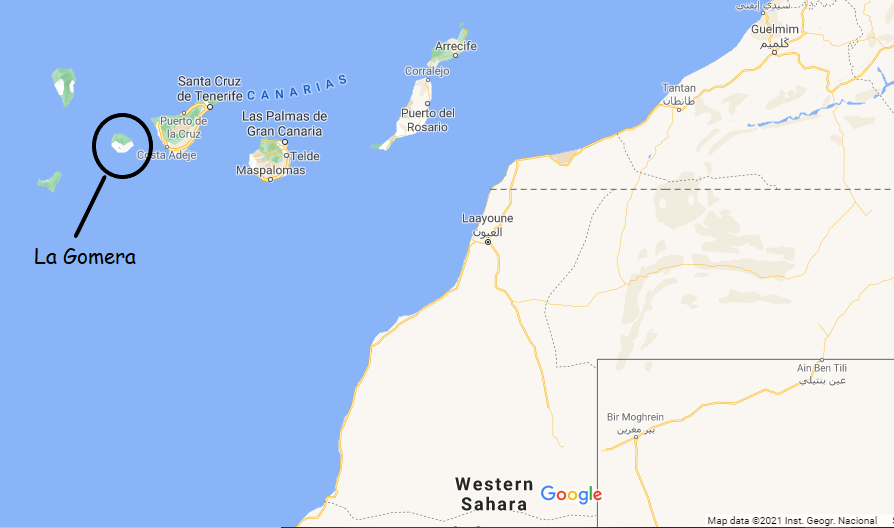
The Canarian Ancient Whistling Language, known as Silbo Gomero. It had all but died out, but for a retired teacher, Eugenio Darias. As a result of his efforts on La Gomera, it now forms part of the school curriculum. Further more, UNESCO has classified it as an Intangible Heritage.

Ancient Whistling Language

History books date the language back to at least 1402 during the initial Spanish Conquest of The Canary Islands. The language made its way to the other islands in the Archipelago during this time. Where it was used by the indigenous Guanchos. The language was in active use as late as the 1950’s.  

The farming and grazing lands are located in the high sided pastures. To cross the many Barrancos (ravines), involves a lot of arduous climbing. As a result the farmers and goat herders would use whistles to share information and ask for help and supplies. It would seem our ancient friends invented WhatsApp!!

Watch these YouTube videos to HEAR the Canarian Ancient Whistling Language is action!


Lanzarote History

There are a number of external sites which have proved useful during our wanderings. As we discover more we will add to the list.

The sites are in Spanish, but translate easily with your browser. There is a History section on the site with a few topics of interest concerning Lanzarote.

Angel Hair

Punta Mujeres - Haria Circular

Angel Hair, you quite often come across some spikey bushes on the side of the path that are covered in a strange golden shroud.

Angel Hair

The actual bush, Aulaga (Launaea arborescens) is very common on Lanzarote. This is partly due to the fact that its thorns protect it from grazing goats. Nevertheless it has enemies, often it is seen covered in this mesh of orange brown threads.

This mesh can only be removed with great difficulty, as it is closely interwoven with the Aluaga. The threads are a plant called Angel Hair (Cuscuta approximata). It is a parasite extracting water and nutrients from its host plant. Everything Cuscuta needs is extracted from the host through specially developed organs growing into the victim.

Angel Hair – Colour

Cuscuta is almost completely lacking in chlorophyll. Which gives rise to its golden colour as opposed to the more normal plant green.

Lanzarote History

To discover more on the history of Lanzarote, there are a couple of external sites which have proved useful during my wanderings.

The sites are in Spanish, so if it helps I have made an attempt to summarise a few topics of interest in the History section.

Punta Mujeres – Haria Circular

Punta Mujeres - Haria Circular

The Punta Mujeres – Haria Circular walk is about 4 – 5 hours depending on breaks, but is well marked throughout. There are two ascents, not steep and good under foot. It’s about 17km as measured on the map, so is probably a little longer.

Punta Mujeres - Haria Circular

In Haria, we took a coffee and cake break at Centro Cultural La Tegala, just across from the Church.

Click the image to open the full walk description in a new tab.

Hike up onto the Haria Plateaux past the many vineyards and small holdings. Explore the strange excavations made into the hillside above Haria. Make your way through the labyrinth of Barrancos of Haria and discover the old abandoned water systems.

Punta Mujeres – Haria Circular – History

To read more on the history of Punta Mujeres and Haria you can checkout the following sites:

The sites are in Spanish, so if it helps I have made an attempt to summarise a few topics of interest in the History section.