

There are two walks in the Uga La Geria area from the same starting point. Walk 1 has a very awkward section marked by the yellow diamond, which is a scramble up a loose picón slope to the rim of Montaña Tinasoria. It is not an official trail, but once on the rim you are back on an official path. The views from the top are definitely worth the effort, covering La Geria and the southern reaches of the island.
Walk 2 is the shorter of the two, never leaves the official trail and is well marked paths or dirt roads all the way.
Directions
Follow the LZ-2 or the LZ-30, south to Uga. From the LZ-2 at the Rotonda de Los Camellos, take the LZ-30 into Uga. I parked on some waste ground near the junction with Calle el Morro.
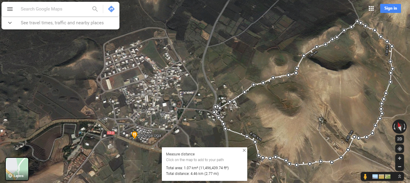
Walk 1 Map

Click on the map image above to open a Google map of the area in a new tab.
Walk 2 Map
Click on the map image above to open a Google map of the area in a new tab.
Uga La Geria – Walk Descriptions
Head east up Calle el Morro, it soon turns into a dirt track as it gently climbs past Montaña Majada, Montaña Majon and Montaña Norte. On the way up notice the old water catchment and concrete spillway on the right. On the left the view opens up over the sweeping vineyards of La Geria.


You eventually arrive at the yellow diamond marked on the map for walk 1. To the left you have a private farm track. To the right you have the continuation of the dirt track and Walk 2. Ahead you have a steep picón slope to the rim of Montaña Tinasoria. This is an awkward unofficial section and not for the feint hearted.
Walk 2
For walk 2, simply continue to follow the dirt track down and back round towards Uga. Take the right fork to skirt the shoulders of Mantañas Majon and Mojada, crossing Barranco del Agua. As you pass between the slopes of Mojada and the Water depository & Base Transceiver Station, you see the path ahead leading back down to the LZ-30 and the start of the walk.
Walk 1
From the spot marked with the yellow diamond, make your ascent to the rim of Montaña Tinasoria. At the top of the scree slope continue right, around the lip, making a second ascent to the highest point of the crater rim. Here you are afforded panoramic views of the La Geria vineyards, the Timanfaya ranges and the southern reaches of the island.


On the coast you can see Arrecife, Puerto del Carman and Puerto Calero. On a clear day there are also views of Los Lobos and Fuerteventura.
Follow the path down and around the crater rim towards some abandoned farm buildings. As you descend, look down and to the left. Carved into the side of the crater you can see evidence of an old water catchment channel running around the bowl of the crater. The channel empties into a series of Aljibes next to the abandoned farm house. There are signs surrounding the old buildings warning of collapse.


The water capture channel not only allowed for the collection of water, but also protected the crater floor from flooding and washing out the grape vine plantation.
The mountain path eventually joins with Camino de la Caldereta, which forms part of the GR-131. Turn left here and follow the track as it winds down through the vineyards of La Geria. The track comes out onto the LZ-30 just outside Uga. Look to the left to see a small path running parallel to the main road leading back to the start point of the walk.


Uga La Geria – History
To read about the history of La Geria and the small village of Uga, you can checkout the following sites:
The sites are in Spanish, so if it helps I have made an attempt to summarise a few topics of interest in the History section.
Click to leave a Google Review