

Guinate Los Helechos is a great hiking area. There are a number of ways to make circular walks, generally all about 2 – 3 hours. There are uphill sections in the walks, but there are either well worn paths or dirt track roads. Sweeping clifftop views out to sea towards La Graciosa. Volcanic craters and panoramic views over the north of the island. There are a number of bars and restaurants in Maguez or Haria. One of my favourites is Restaurante Volcan de La Corona in Ye.
Directions
Take the LZ-1 out of Arrecife. First exit at the round-a-bout in Tahiche. Continue on the LZ-1 past Costa Teguise, Guatiza and Mala. In Arrieta at the round-a-bout you have a choice, either take the 3rd exit for Harria (LZ-10), follow the signs for Maguez and Guinate .
Or straight ahead at the round-a-bout in Arrieta and follow the signs for Mirador de Rio (LZ-201). In the village of Ye however, ignore the Mirador de Rio signs, continue through the village. After about 1.7km take the righthand turning for Guinate.
Whichever route taken, once heading into the village of Guinate, Calle Majadita, take the left fork Calle El Rincon. I usually park at the Sociedad.
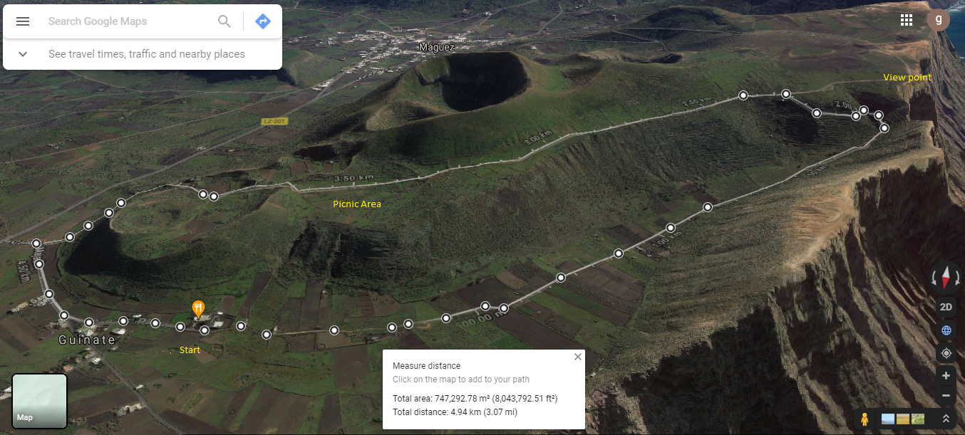
Click on the map image above to open a Google map of the area in a new tab.
The Walk – Route 1
This is quite an easy one, great for families, about 2 hours, gentle dirt road climb, well marked.
Head west from from the Soceidad into the valley, passing a number of farms and small holdings. At the head of the valley, the track starts to climb, winding it’s way to the top where it joins Calle la Caldera. Here you see a noticeboard explaining about the Fuentes de Gayo, an old water source.


A short walk further west brings you to the clifftop views over the Famara Massif, out towards La Gracisoa and back towards Caleta de Famara.


After taking in the views, retrace your steps back to the Fuentes de Gayo notice board. Continue along the dirt track with views down to the valley floor on your left. There are several notice boards along the track describing the views and history of the area. Towards the end of the track there is a popular picnic spot with views across the valley and down into the village.


After a short descent the track joins Calle Majadita, which you follow back to the fork with Calle El Rincon and the start of the walk.
It’s not always open, but just before the Sociedad is a quaint little Church. It was the then Mayor Don Juan-José Santana de León in the early 70’s that acquired the land. And it was the villages themselves that provided the labour for both projects.
Guinate Los Helechos History
The Historia de Haria website has lots of information about the area. In particular there are articles about the village itself and the Risqueros de Guinate.
These sites are in Spanish, so if it helps I have made an attempt to summarise a few topics of interest in the History section.